
What are hydric soils, and why do they matter for septic?
SepticFactsPublished Updated
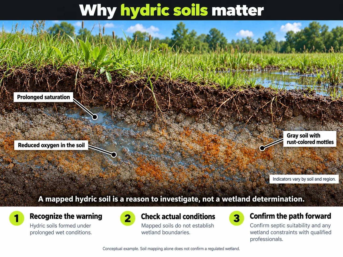
Hydric soils are soils with long-lasting low-oxygen (anaerobic) conditions.1 They matter for septic because a drainfield, the shallow, covered area where soil treats the wastewater, is built in unsaturated soil.2 A soil survey that lists part or all of a lot’s soil as hydric is a reason to look closer before you buy.
What are the characteristics of hydric soil?
In long-saturated soil, oxygen runs out.
Wet soil often looks gray, or has gray mottles (spots), below the surface.3 Mottles are spots of a different color from the soil around them.
Why do hydric soils matter for septic?
A drainfield needs soil that is not saturated for extended periods.4 Where groundwater is high, systems beyond the conventional design, such as a mound, can be used.5
A lot on wet soil may need an alternative system or extra steps. A soil survey that lists part or all of the lot as hydric is a reason to ask the agency that issues septic permits where the lot is (often the county health department) what applies to the lot.
Can I build on hydric soil?
Hydric soil raises two separate questions: whether septic can be permitted on the spot, and whether the area is a wetland. Ask the septic permitting agency about septic. Ask the county or a wetland professional how wetlands are identified for the lot.
Under the Corps of Engineers’ 1987 manual, a wetland needs evidence of all three signs, hydric soil, hydrophytic vegetation and wetland hydrology, except in certain situations the manual defines. A hydric soil alone does not make an area a wetland.6 Hydrophytic vegetation means plants that grow in wet conditions, and wetland hydrology means the presence of water. For a worked state example, SiteFacts has a longer guide to Oregon’s rules: The Hidden Cost of Hydric Soils.
What if the soil survey lists hydric soil on the lot?
Walk the lot after a wet spell if you can, and note any standing water, soggy ground or low spots. Ask the seller whether a soil evaluation or a wetland review has ever been done on the lot, and ask for a copy of any report. Keep the copy with your purchase records. Ask the septic permitting agency what evaluation it would need for septic. Take dated photos of any wet areas, and note the season, since wet ground looks different in dry months. Share the photos with the seller and the evaluator. If wet ground is part of the picture, ask the county or a wetland professional how wetlands are identified for the lot before you commit. A SepticFacts screening estimate shows what the mapped soil data says for a parcel and notes that the soil mapping is county-scale.
How reliable are hydric soil maps?
Soil maps are county-scale. They group soils into map units, which are areas mapped as one kind of soil. A map unit’s description may not match the soil at a given spot.7
A hydric listing in a soil survey is a starting point, not a result for the spot. It does not tell you what is at the drainfield spot, so a field evaluation, which is soil testing on the lot itself, is the next step.
Citations
-
USDA NRCS, Field Indicators of Hydric Soils in the United States, Version 9.3 (2026); U.S. Army Corps of Engineers, Wetlands Delineation Manual (Technical Report Y-87-1, 1987). ↩
-
U.S. EPA, How Your Septic System Works; University of Minnesota Onsite Sewage Treatment Program, All about septics. ↩
-
SERA-17, Septic Drain Field Design and Maintenance (University of Kentucky and USDA-ARS, hosted by NC State University); U.S. Army Corps of Engineers, Wetlands Delineation Manual (1987). ↩
-
U.S. EPA, How Your Septic System Works; University of Minnesota Onsite Sewage Treatment Program, All about septics. ↩
-
U.S. EPA, Types of Septic Systems; Oregon Department of Environmental Quality, About Septic Systems. ↩
-
U.S. Army Corps of Engineers, Wetlands Delineation Manual (1987); U.S. EPA, What is a Jurisdictional Delineation under CWA Section 404? ↩
-
USDA NRCS Web Soil Survey, Hydric Soils report for Screven County, Georgia; U.S. Army Corps of Engineers, Wetlands Delineation Manual (1987). ↩
The agency that issues septic permits where the lot is makes the final call on what system your lot can use.
Sources
- Field Indicators of Hydric Soils in the United States, Version 9.3 (2026)U.S. Department of Agriculture, Natural Resources Conservation Service (federal)Corroborated; confirm with the authority. Checked
- Hydric Soils, Screven County, Georgia (Web Soil Survey report, archived)USDA Natural Resources Conservation Service, Web Soil Survey (federal)Corroborated; confirm with the authority. Checked
- Corps of Engineers Wetlands Delineation Manual (Technical Report Y-87-1)U.S. Army Corps of Engineers, Waterways Experiment Station (federal)Corroborated; confirm with the authority. Checked
- What is a Jurisdictional Delineation under CWA Section 404?U.S. Environmental Protection Agency (federal)Corroborated; confirm with the authority. Checked
- Septic Drain Field Design and MaintenanceSERA-17 fact sheet hosted by NC State University, authored by the University of Kentucky and USDA-ARS (state university extension and federal research)Corroborated; confirm with the authority. Checked
- How Your Septic System WorksU.S. Environmental Protection Agency (federal)Corroborated; confirm with the authority. Checked
- Types of Septic SystemsU.S. Environmental Protection Agency (federal)Corroborated; confirm with the authority. Checked
- All about septicsUniversity of Minnesota Onsite Sewage Treatment Program (state university extension)Corroborated; confirm with the authority. Checked
- About Septic Systems (Residential Resources)Oregon Department of Environmental Quality (state)Corroborated; confirm with the authority. Checked
Related on sitefactsreport.com
The Hidden Cost of Hydric Soils
Check a specific lot
SepticFacts screens one lot against public soil, flood, wetland and slope data and the local septic rules we have on file, with every source cited.
Check a lot